Kensington Park Road, W11

Road in/near Notting Hill, existing between the 1840s and now.

 HOME  ·  ARTICLE  ·  MAPS  ·  STREETS  ·  BLOG  ·  CONTACT US 
(51.5137 -0.2046, 51.513 -0.204) 
MAP YEAR:175018001810182018301860190019502024Show map without markers
TIP: To create your own sharable map, right click on the map
 
Road · * · W11 ·
September
14
2021
Kensington Park Road is one of the main streets in Notting Hill.

Kensington Park Road was built over a long period between the early 1840s and the 1870s by a variety of different developers.

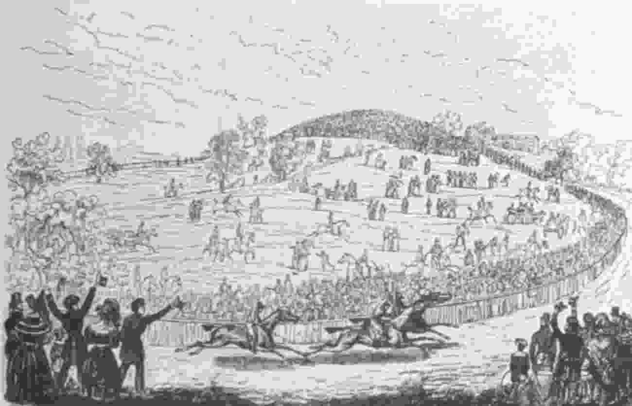
Originally, there was no north-south road parallel to Portobello Lane (as Portobello Road was known). In 1840, after the failure of the Hippodrome racecourse (the main entrance of which was about where Kensington Temple now is), James Weller Ladbroke signed an agreement with a developer, Joseph Connop, under which Connop agreed to develop a large portion of the estate between Portobello Road and roughly what is now Ladbroke Grove. The deal was that Connop would arrange for the building of roads, sewers and houses and Ladbroke undertook then to give him 99-year leases of the houses for a small ground rent; Connop would then recover his costs through letting the houses. A plan for Connop’s land was drawn up by an architect called John Stevens.

Kensington Park was the name chosen by the developer Pearson Thompson when in 1842 he prepared a grandiose and only partly realised plan for developing this part of the Ladbroke estate.

John Stevens designed a new north-south street - the future Kensington Park Road, just west of Portobello Lane. The road seems to have been intended partly to cut off the wealthy inhabitants of the new Ladbroke estate houses from too much contact with the rougher area of Portobello Lane. By 1843, five villas had been completed in the new road (Nos. 44-52, subsequently demolished and replaced by Matlock Court, Buckingham Court and Princes House).

Ladbroke had entered into a separate agreement with another developer, William Chadwick, for the southernmost parts of Kensington Park Road and Ladbroke Road. Chadwick began by building the Prince Albert public house (pubs were a good way to relive building workers of their wages to the profit of the developer). By 1848, Chadwick had built three sets of semi-detached villas houses on the east side of Kensington Park Road, of which Nos. 32 to 38 have survived. Around the same time, a congregational chapel (now Kensington Temple) was built on the opposite corner site. Chadwick was also responsible for the long terrace at Nos. 4-30 evens Kensington Park Road.

After various further buying and selling of plots between developers, the part of Kensington Park Road between Latimer House and Westbourne Road was developed by yet another developer, Thomas Pocock. He was responsible for Nos. 56-64 and the long terrace at Nos. 126-182 Kensington Park Road, all in the early 1850s.

By this time the developers on the Ladbroke estate were running into financial difficulties and it was not until the late 1850s and 1860s that building on Kensington Park Road resumed. By this time the Ladbroke family had disposed of the freeholds of much of the undeveloped land on the estate to a variety of speculators. In 1855, the speculator Charles Blake acquired all the freehold land on the east side of Kensington Park Road between Westbourne Grove and the backs of the houses on the north side of Chepstow Villas. Blake’s first move was to present the Ecclesiastical Commissioners (and the inhabitants of his estate) with a site for a church, St. Peter’s, well placed to close the vista along Stanley Gardens, of which he was also the developer. St Peter’s was designed by Thomas Allom, the main architect working on the Ladbroke estate in the 1850s.

Blake also arranged for the erection of the terrace to the south of the church, Nos. 76-90 (evens). By this time, Blake was running into financial difficulties, and he then sold on the land north of St Peter’s in 1861 to Joseph Offord, a speculating coachbuilder from Marylebone. He arranged for the erection of Nos. 92-112 evens in about 1861. Now only Nos. 92-96 survive. In the meantime, Nos. 1-15 odds on the west side were completed around 1860.

There is not a lot of information on the building of the northern end of Kensington Park Road, although leases survive which show that Nos. 124 and 184 were built around 1853. The Peniel Chapel was erected in the 1870s, replacing a church built in 1862 that had been destroyed by fire.

Kensington Park Road originally had a number of separately named terraces: Horbury Terrace; Kensington Park Villas; Kensington Park Gardens East; Kensington Park Terrace; St Peter’s Terrace; Kensington Park Terrace North (the name of which can still be seen inscribed on numbers 152 and 154, the central houses of the terrace); Howard Place; Sussex Terrace; and Convent Terrace.


Main source: Ladbroke Association
Further citations and sources


Click here to explore another London street
We now have 665 completed street histories and 46835 partial histories
Find streets or residential blocks within the M25 by clicking STREETS


CONTRIBUTIONS TO THE LOCALITY

Lived here
Richard   
Added: 12 Jul 2022 21:36 GMT   

Elgin Crescent, W11
Richard Laitner (1955-1983), a barrister training to be a doctor at UCL, lived here in 1983. He was murdered aged 28 with both his parents after attending his sister’s wedding in Sheffield in 1983. The Richard Laitner Memorial Fund maintains bursaries in his memory at UCL Medical School

Source: Ancestry Library Edition

Reply
Reply
Richard   
Added: 12 Jul 2022 21:39 GMT   

Elgin Crescent, W11
Richard Laitner lived at 24 Elgin Crescent

Source: Ancestry Library Edition

Reply

Ken Herlingshaw   
Added: 17 Jun 2023 18:34 GMT   

St John the Evangelist - Spire
The top of the church spire fell off during WW2 (presumably during a bombing raid ?) and for many years after that the spire had a flat top.
I don’t know when it was restored.
Definitely not in the early fifties when I went to Sunday School there.

Reply
Comment
Ken Herlingshaw   
Added: 17 Jun 2023 18:35 GMT   

Clarendon Road - post WW2
I used to live at 62 Clarendon Road, from about 1947 to 1956.
It was one of four prefabs on the site, numbers 60, 60A, 62 and 62A.
The original building there (on the corner with Lansdowne Rise) was bombed during WW2.
Prefabs weren’t very popular with the up-market Kensington Borough councillors, however, and at the earliest opportunity they were demolished and we were moved to Henry Dickens Court.
We inherited a telephone line from the original occupier, a band leader, when we moved into the prefab and the phone number was BAYswater 0050. But we didn’t know anybody else with a phone to call.

Reply
Reply
mh   
Added: 21 Jun 2023 12:15 GMT   

Clarendon Road, W11
Interesting....

Reply

Christian   
Added: 31 Oct 2023 10:34 GMT   

Cornwall Road, W11
Photo shows William Richard Hoare’s chemist shop at 121 Cornwall Road.

Reply

LATEST LONDON-WIDE CONTRIBUTIONS TO THE PROJECT

Comment
Wendy    
Added: 22 Mar 2024 15:33 GMT   

Polygon Buildings
Following the demolition of the Polygon, and prior to the construction of Oakshott Court in 1974, 4 tenement type blocks of flats were built on the site at Clarendon Sq/Phoenix Rd called Polygon Buildings. These were primarily for people working for the Midland Railway and subsequently British Rail. My family lived for 5 years in Block C in the 1950s. It seems that very few photos exist of these buildings.

Reply

Steve   
Added: 19 Mar 2024 08:42 GMT   

Road construction and houses completed
New Charleville Circus road layout shown on Stanford’s Library Map Of London And Its Suburbs 1879 with access via West Hill only.

Plans showing street numbering were recorded in 1888 so we can concluded the houses in Charleville Circus were built by this date.

Source: Charleville Circus, Sydenham, London

Reply
Comment
Steve   
Added: 19 Mar 2024 08:04 GMT   

Charleville Circus, Sydenham: One Place Study (OPS)
One Place Study’s (OPS) are a recent innovation to research and record historical facts/events/people focused on a single place �’ building, street, town etc.

I have created an open access OPS of Charleville Circus on WikiTree that has over a million members across the globe working on a single family tree for everyone to enjoy, for free, forever.

Source: Charleville Circus, Sydenham, London

Reply
Comment
Charles   
Added: 8 Mar 2024 20:45 GMT   

My House
I want to know who lived in my house in the 1860’s.

Reply

NH   
Added: 7 Mar 2024 11:41 GMT   

Telephone House
Donald Hunter House, formerly Telephone House, was the BT Offices closed in 2000

Reply
Comment
Paul Cox   
Added: 5 Mar 2024 22:18 GMT   

War damage reinstatement plans of No’s 11 & 13 Aldine Street
Whilst clearing my elderly Mothers house of general detritus, I’ve come across original plans (one on acetate) of No’s 11 & 13 Aldine Street. Might they be of interest or should I just dispose of them? There are 4 copies seemingly from the one single acetate example. Seems a shame to just junk them as the level of detail is exquisite. No worries if of no interest, but thought I’d put it out there.

Reply
Comment
Diana   
Added: 28 Feb 2024 13:52 GMT   

New Inn Yard, E1
My great grandparents x 6 lived in New Inn Yard. On this date, their son was baptised in nearby St Leonard’s Church, Shoreditch

Source: BDM London, Cripplegate and Shoreditch registers written by church clerk.

Reply
Comment
Vic Stanley   
Added: 24 Feb 2024 17:38 GMT   

Postcose
The postcode is SE15, NOT SE1

Reply


LOCAL PHOTOS
Click here to see map view of nearby Creative Commons images
Click here to see Creative Commons images near to this postcode
Click here to see Creative Commons images tagged with this road (if applicable)
Coronation street party, 1953.
TUM image id: 1545250697
Licence: CC BY 2.0
Notting Hill
TUM image id: 1510169244
Licence: CC BY 2.0
Pembridge Road (1900s)
TUM image id: 1556889569
Licence: CC BY 2.0
Kensington Park Hotel
TUM image id: 1453375720
Licence: CC BY 2.0

In the neighbourhood...

Click an image below for a better view...
Children of Ruston Close This road was the renaming of Rillington Place. Even after renaming, this street, where notorious murders had taken place, proved too much to avoid subsequent demolition.
Licence:


The Tile Kiln, Notting Dale (1824)
Credit: Florence Gladstone
Licence: CC BY 2.0


Kensington Park Hotel
Licence: CC BY 2.0


The Tabernacle is a Grade II*-listed building in Powis Square, W11 built in 1887 as a church. Photographed here in 2010.
Credit: Asteuartw
Licence: CC BY 2.0


Duke of Cornwall, Ledbury Road W11, around 1990. Later the Ledbury restaurant, holder of two Michelin Stars
Licence:


St Peter's Notting Hill
Credit: Asteuartw
Licence: CC BY 2.0


Kensington Hippodrome, about 1840, showing St John’s Hill in the background.
Licence:


SARM Studios, a recording studio, was established by Chris Blackwell, the founder of Island Records. They were originally known as Basing Street Studios. It has also been known in the past as Island Studios. SARM is an aconym of Sound and Recording Mobiles. At the studios, built inside a former church that had been deconsecrated, Blackwell recorded a number of artists there for Island Records, such as Iron Maiden, Bob Marley, Steve Winwood, Free, Bad Company, Robert Palmer, Jimmy Cliff, Nick Drake, Fairport Convention, King Crimson, John Martyn, Mott the Hoople, Quintessence, Roxy Music, Brian Eno, Sparks, Cat Stevens, Spooky Tooth, Traffic, If, Jethro Tull, the Average White Band, and the Sensational Alex Harvey Band.
Licence:


Arundel Gardens
Credit: Barbara Avis
Licence:


Boyne Terrace Mews, W11
Licence: CC BY 2.0


  Contact us · Copyright policy · Privacy policy