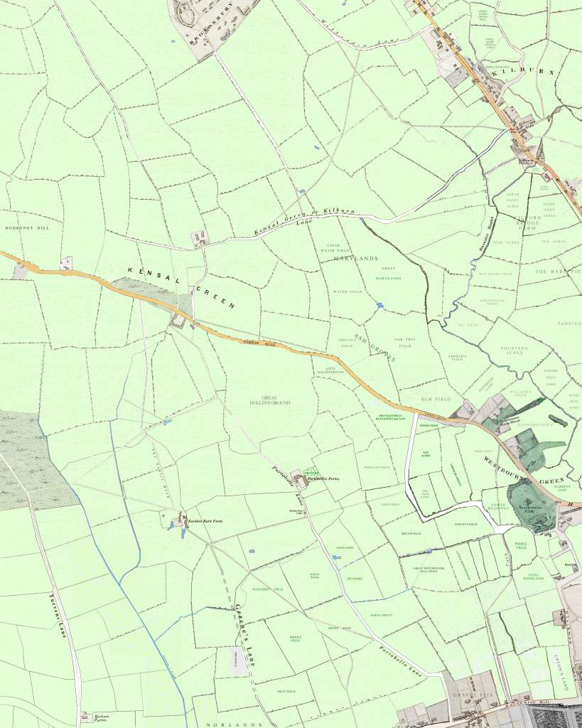
This map of the 1800 countryside in the area which covers today’s London W10 postcode has been compiled by The Underground Map from various sources.
As its main source, the Milne map of London shows the landuse of fields and the routes of lanes. An 1834 map of Marylebone Parish provided field names up to the edge of the parish, with Florence Gladstone’s description of the Portobello Road area providing field names further west.
The 1860s Edward Stanford map showed the exact position of field boundaries in the area north of the Harrow Road which had not, until that decade, been developed. the 1830s Greenwood map, which takes the view of London on;y as far west as Westbourne Green, provides a similar task of locating 1830s field boundaries.
One of the major discussion points of this map is what is missing – the Grand Union Canal was laid out through the area in the years just after 1800. This had a dramatic effect on the landscape. Notably, in the years afterwards, Kensal New Town developed south of the new canal but cut off from Kensal Green, north of it.

