Dollis Hill

Underground station, existing between 1909 and now.

 HOME  ·  ARTICLE  ·  MAPS  ·  STREETS  ·  BLOG  ·  CONTACT US 
(51.552 -0.239, 51.552 -0.239) 
MAP YEAR:175018001810182018301860190019502023Show map without markers
ZOOM:14 15 16 17 14 15 16 17 14 15 16 17 14 15 16 17 14 15 16 17 14 15 16 17 14 15 16 17 18 14 15 16 17 14 15 16 17 18
TIP: Adjust the MAP YEAR and ZOOM to tweak historical maps
Underground station · Dollis Hill · ·
APRIL
10
2021
Dollis Hill tube station lies on the Jubilee Line, between Willesden Green and Neasden. Metropolitan Line trains pass though the station, but do not stop.

On looking at the 1900 map of the area around Dollis Hill station, one might notice an immediate problem - Dollis Hill itself isn't there at all. The nearby area, in those days, was called Dudden Hill.

The Dollis Hill Estate was formed in the early 19th century, when the Finch family bought up a number of farms in the area to form a single estate, and it is somewhat to the north of the later location of the station. Dollis Hill House was built in the 1820s.

William Ewart Gladstone, the UK Prime Minister, was a frequent visitor to Dollis Hill House in the late 19th century. The year after his death, 1899, Willesden Council acquired much of the Dollis Hill Estate for use as a public park, which was named Gladstone Park.

Mark Twain stayed in Dollis Hill House in the summer of 1900. He wrote that ’Dollis Hill comes nearer to being a paradise than any other home I ever occupied’.

The code-breaking Colossus computer, used at Bletchley Park during the Second World War, was built at the Post Office Research Station in Dollis Hill by a team lead by Tommy Flowers. The station was relocated to Martlesham Heath at the end of the 1970s.

A World War II bunker for Winston Churchill called Paddock is located here.

The fictional Dollis Hill Football Club features occasionally in the British satirical magazine Private Eye, and Dollis Hill tube station, although real, is frequently played in the radio panel game Mornington Crescent.

dollishill0Until the end of the nineteenth century, Dollis Hill was still a very rural backwater. The tube station was yet to be built (completed in 1907) and Dollis Hill Lane was the main thoroughfare through the area which was only later to be built up.
Dollis Hill Lane connected (and still does) the Edgware Road and Neasden. Dollis Hill Lane is not immediately locatable on the "slippy map" from 1900 at the top of the page since the red marker shows the future site of the tube station. Dollis Hill Lane is quite a way north.

About halfway along its length, Dollis Hill House had been built, opposite its farm, in 1825.

Author Mark Twain, stayed at Dollis Hill House, built along the lane, in the summer of 1900. Twain wrote that he had "never seen any place that was so satisfactorily situated, with its noble trees and stretch of country, and everything that went to make life delightful, and all within a biscuit's throw of the metropolis of the world." "There is no suggestion of city here; it is country, pure and simple, and as still and reposeful as is the bottom of the sea." He later wrote "Dollis Hill comes nearer to being a paradise than any other home I ever occupied".

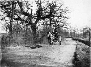
That same year, a photographer was at large along the lane. It is unclear who was photographed here in the year 1900, but the man and a woman in a two-wheeled carriage, may have been coming to or from the house.

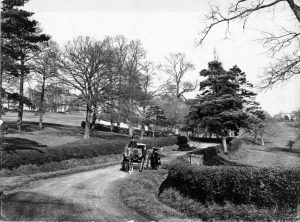
dollishill1There is the possibility that this set of photographs shows an outing from the house, since here we see a different couple of people; the man is in a top hat and the woman shading herself from the winter sun using an umbrella.
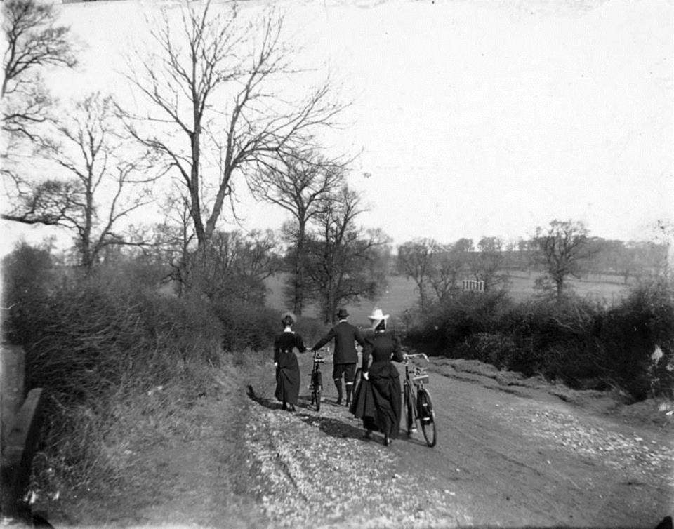
In the final image of the 1900 series, pictured below, a group of people are pushing their bicycles along Dollis Hill Lane.


dollishill2


Main source: Hidden London
Further citations and sources


Click here to explore another London street
We now have 643 completed street histories and 46857 partial histories
Find streets or residential blocks within the M25 by clicking STREETS


CONTRIBUTIONS TO THE LOCALITY


Kevin Pont   
Added: 30 Aug 2023 09:47 GMT   

The connection with Bletchley Park
The code-breaking computer used at Bletchley Park was built in Dollis Hill.

Reply

Brian Lynch   
Added: 10 Apr 2022 13:38 GMT   

Staples Mattress Factory
An architect’s design of the Staples Mattress Factory
An image found on the website of Dalzell’s Beds, in Armagh Northern Ireland.

Reply

LATEST LONDON-WIDE CONTRIBUTIONS TO THE PROJECT


Sue   
Added: 24 Sep 2023 19:09 GMT   

Meyrick Rd
My family - Roe - lived in poverty at 158 Meyrick Rd in the 1920s, moving to 18 Lavender Terrace in 1935. They also lived in York Rd at one point. Alf, Nell (Ellen), plus children John, Ellen (Did), Gladys, Joyce & various lodgers. Alf worked for the railway (LMS).

Reply
Born here
Michael   
Added: 20 Sep 2023 21:10 GMT   

Momentous Birth!
I was born in the upstairs front room of 28 Tyrrell Avenue in August 1938. I was a breach birth and quite heavy ( poor Mum!). My parents moved to that end of terrace house from another rental in St Mary Cray where my three year older brother had been born in 1935. The estate was quite new in 1938 and all the properties were rented. My Father was a Postman. I grew up at no 28 all through WWII and later went to Little Dansington School

Reply

Mike Levy   
Added: 19 Sep 2023 18:10 GMT   

Bombing of Arbour Square in the Blitz
On the night of September 7, 1940. Hyman Lubosky (age 35), his wife Fay (or Fanny)(age 32) and their son Martin (age 17 months) died at 11 Arbour Square. They are buried together in Rainham Jewish Cemetery. Their grave stones read: "Killed by enemy action"

Reply

Lady Townshend   
Added: 8 Sep 2023 16:02 GMT   

Tenant at Westbourne (1807 - 1811)
I think that the 3rd Marquess Townshend - at that time Lord Chartley - was a tenant living either at Westbourne Manor or at Bridge House. He undertook considerable building work there as well as creating gardens. I am trying to trace which house it was. Any ideas gratefully received

Reply

Alex Britton   
Added: 30 Aug 2023 10:43 GMT   

Late opening
The tracks through Roding Valley were opened on 1 May 1903 by the Great Eastern Railway (GER) on its Woodford to Ilford line (the Fairlop Loop).

But the station was not opened until 3 February 1936 by the London and North Eastern Railway (LNER, successor to the GER).

Source: Roding Valley tube station - Wikipedia

Reply
Comment
Kevin Pont   
Added: 30 Aug 2023 09:52 GMT   

Shhh....
Roding Valley is the quietest tube station, each year transporting the same number of passengers as Waterloo does in one day.

Reply
Comment
Kevin Pont   
Added: 29 Aug 2023 15:25 GMT   

The deepest station
At 58m below ground, Hampstead is as deep as Nelson’s Column is tall.

Source: Hampstead tube station - Wikipedia

Reply
Comment
Kevin Pont   
Added: 29 Aug 2023 15:15 GMT   

Not as Central as advertised...
Hendon Central was by no means the centre of Hendon when built, being a green field site. It was built at the same time as both the North Circular Road and the A41 were built as major truck roads �’ an early example of joined up London transport planning.

Reply


NEARBY LOCATIONS OF NOTE
Dollis Hill Dollis Hill tube station lies on the Jubilee Line, between Willesden Green and Neasden. Metropolitan Line trains pass though the station, but do not stop.

THE STREETS OF DOLLIS HILL
Aberdeen Road, NW10 Aberdeen Road is a road in the NW10 postcode area
Aboyne Road, NW2 Aboyne Road is a road in the NW2 postcode area
Addis Court, NW2 Addis Court is a block on Grunwick Close.
Ainsworth Close, NW2 Ainsworth Close is a road in the NW2 postcode area
Alder Grove, NW2 Alder Grove is a street in Cricklewood.
Allies House, NW2 Residential block
Applewood Close, NW2 Applewood Close is a road in the NW2 postcode area
Apsley Way, NW2 Apsley Way is a street in Cricklewood.
Aquarius Business Park, NW2 Aquarius Business Park is a location in London.
Arnoux Court, NW2 Arnoux Court is sited on Grunwick Close.
Ashcombe Park Road, NW2 Ashcombe Park Road is a location in London.
Ashcombe Park, NW2 Ashcombe Park is a road in the NW2 postcode area
Atlas Business Centre, NW2 Atlas Business Centre is a location in London.
Attewood Avenue, NW2 Attewood Avenue is a street in Willesden.
Avondale Avenue, NW2 Avondale Avenue is a road in the NW2 postcode area
Ballards Road, NW2 Ballards Road is a street in Cricklewood.
Birse Crescent, NW10 Birse Crescent is a road in the NW10 postcode area
Broadfield Close, NW2 Broadfield Close is a road in the NW2 postcode area
Brook Road, NW2 Brook Road is a street in Cricklewood.
Burnley Road, NW10 Burnley Road runs parallel with the tracks of the Metropolitan/Jubilee line, to the north of them.
Byron Road, NW2 Byron Road is a road in the NW2 postcode area
Cairnfield Avenue, NW2 Cairnfield Avenue is a street in Cricklewood.
Campbell Gordon Way, NW2 Campbell Gordon Way is a street in Cricklewood.
Chartley Avenue, NW2 Chartley Avenue is a street in Cricklewood.
Chipstead Gardens, NW2 Chipstead Gardens is a road in the NW2 postcode area
Church Walk House, NW2 Residential block
Clifford Way, NW10 Clifford Way is a street in Willesden.
Coles Green Court, NW2 Coles Green Court is a building on Coles Green Court.
Coles Green Road, NW2 Coles Green Road, once part of Oxgate Lane, is an original road of the area.
Comber Close, NW2 Comber Close is a road in the NW2 postcode area
Cooper Road, NW10 Cooper Road is a small crescent next to Dollis Hill station.
Copper Mead Close, NW2 Copper Mead Close is a location in London.
Coppermead Close, NW2 Coppermead Close is a road in the NW2 postcode area
Cornmow Drive, NW10 Cornmow Drive is a road in the NW10 postcode area
Crest Road, NW2 Crest Road is a street in Cricklewood.
Cullingworth Road, NW10 Cullingworth Road is a road in the NW10 postcode area
Dawpool Road, NW2 Dawpool Road is a street in Cricklewood.
Dewsbury Road, NW10 Dewsbury Road is a road in the NW10 postcode area
Dollis Hill Avenue, NW2 Dollis Hill Avenue is named after the Dollis Brook. ’Dollis’ comes from the Saxon word Dwllice meaning ’erratic’.
Dollis Hill Lane, NW2 Dollis Hill Lane is an ancient throughway.
Dudden Hill Lane, NW10 Dudden Hill Lane was named after a Saxon settler called Dodda.
Dudden Hill Parade, NW10 Dudden Hill Parade is a street in Willesden.
Eastleigh Close, NW2 Eastleigh Close is a road in the NW2 postcode area
Edgware Road, NW2 Edgware Road originated as part of Roman Watling Street and runs for 10 miles in an almost straight line.
Ellesmere Road, NW10 Ellesmere Road is a street in Willesden.
Eyhurst Close, NW2 Eyhurst Close is a road in the NW2 postcode area
Field Close, NW2 Field Close is a location in London.
Fleetwood Road, NW10 Fleetwood Road is a street in Willesden.
Flowers Close, NW2 Flowers Close belated recognised Tommy Flowers, designer of the Colossus computer.
Forbes Close, NW2 Forbes Close is a road in the NW2 postcode area
Geary Road, NW10 Geary Road is a street in Willesden.
Geron Way, NW2 Geron Way is a street in Cricklewood.
Gladstone Parade, NW2 Gladstone Parade is a street in Cricklewood.
Gladstone Park Gardens, NW2 Gladstone Park Gardens is a street in Cricklewood.
Griffin Close, NW10 Griffin Close is a road in the NW10 postcode area
Grunwick Close, NW2 Grunwick Close was the location of the Grunwick factory, heart of a notable 1970s labour dispute.
Hamilton Road, NW10 Hamilton Road is a street in Willesden.
Harp Business Centre, NW2 Harp Business Centre is a street in Cricklewood.
Hawarden Hill, NW2 Hawarden Hill is a road in the NW2 postcode area
Heather Road, NW2 Heather Road is a road in the NW2 postcode area
Helena Road, NW10 Helena Road is a street in Willesden.
Hill Close, NW2 Hill Close is a road in the NW2 postcode area
Hillcrest Gardens, NW2 Hillcrest Gardens is a location in London.
Homestead Park, NW2 Homestead Park consists of twenty one dwelling-houses located on the north side of Dollis Hill Lane.
Horseshoe Close, NW2 Horseshoe Close is a street in Cricklewood.
Horseshoe Estate, NW2 Commercial area
Humber Road, NW2 Humber Road is a street in Cricklewood.
Kelceda Close, NW2 Kelceda Close is a road in the NW2 postcode area
Kendal Road, NW10 Kendal Road is a street in Willesden.
Kenwyn Drive, NW2 Kenwyn Drive is a street in Cricklewood.
Lancaster Road, NW10 Lancaster Road is a street in Willesden.
Lennox Gardens, NW10 Lennox Gardens is a road in the NW10 postcode area
Links Road, NW2 Links Road is a street in Cricklewood.
Longberrys, NW2 Longberrys is a street in Cricklewood.
Lovat Close, NW2 Lovat Close is a road in the NW2 postcode area
Lukes Close, EC1V Lukes Close is a location in London.
Magic House, NW2 Magic House is a location in London.
Mascotts Close, NW2 Mascotts Close is a road in the NW2 postcode area
Midwood Close, NW2 Midwood Close is a road in the NW2 postcode area
Millennium Business Centre Humber Trading Estate, NW2 Millennium Business Centre is on the Humber Trading Estate.
Mount Road, NW2 Mount Road is a road in the NW2 postcode area
Mulgrave Road, NW10 Mulgrave Road is a road in the NW10 postcode area
Neasden Parade, NW10 Neasden Parade is a street in Willesden.
Nevilles Court, NW2 Nevilles Court is a street in Cricklewood.
New Row, NW2 New Row is a location in London.
Newfield Rise, NW2 Newfield Rise is a street in Cricklewood.
Normanby Road, NW10 Normanby Road is a road within the Dudden Hill Estate.
North Circular Road, NW2 The Dollis Hill section of the North Circular Road leads west from Staples Corner.
Nutfield Road, NW2 Nutfield Road is a road in the NW2 postcode area
Orchard Close, NW2 Orchard Close is a road in the NW2 postcode area
Oxgate Centre, NW2 Oxgate Centre is a road serving an industrial estate west of the Edgware Road.
Oxgate Court Parade, NW2 Oxgate Court Parade is a parade of shops lying underneath Oxgate Court.
Oxgate Court, NW2 Oxgate Court is a block on Coles Green Road.
Oxgate Gardens, NW2 Oxgate Gardens is a street in Cricklewood.
Oxgate Lane, NW2 Oxgate Lane is an old road in the Dollis Hill area.
Oxleys Road, NW2 Oxleys Road is a road in the NW2 postcode area
Paddock Road, NW2 Paddock Road is a road in the NW2 postcode area
Park Avenue North, NW10 Park Avenue North is a street in Willesden.
Park Lodge, NW2 Park Lodge is a street in Cricklewood.
Park Side, NW2 Park Side is a street in Cricklewood.
Park View Road, NW10 Park View Road is a street in Willesden.
Parkside, NW2 Parkside is a road in the NW2 postcode area
Phoenix Park, NW2 Phoenix Park is a location in London.
Pinemartin Close, NW2 Pinemartin Close is a street in Cricklewood.
Pippin Close, NW2 Pippin Close is a road in the NW2 postcode area
Priestley Way, NW2 Priestley Way is a street in Cricklewood.
Randall Avenue, NW2 Randall Avenue is a street in Cricklewood.
Review Road, NW2 Review Road is a street in Cricklewood.
Rose Croft Gardens, NW2 Rose Croft Gardens is a cul-de-sac off of Dollis Hill Lane.
Rosecroft Gardens, NW2 Rosecroft Gardens is a location in London.
Rowan House, NW10 Residential block
Rylandes Road, NW2 Rylandes Road is a road in the NW2 postcode area
Sancroft Close, NW2 Sancroft Close is a road in the NW2 postcode area
Sayer House, NW2 Sayer House is a location in London.
Selsdon Road, NW2 Selsdon Road is a street in Cricklewood.
Shepherds Walk, NW2 Shepherds Walk is a road in the NW2 postcode area
Sherrick Green Road, NW10 Sherrick Green Road is a street in Willesden.
Sonia Gardens, NW10 Sonia Gardens is a road in the NW10 postcode area
St Andrews Close, NW2 St Andrews Close is a road in the NW2 postcode area
Staples Corner Business Park, NW2 Staples Corner Business Park is situated next to Staples Corner.
Staples Corner Retail Park, NW2 Staples Corner Retail Park is a location in London.
Staples Corner West Roundabout, NW2 Staples Corner West Roundabout is a road in the NW2 postcode area
Staples Corner, NW2 Staples Corner is a road in the NW4 postcode area
Streakes Field Road, NW2 Streakes Field Road is a road in the NW2 postcode area
Tadworth Road, NW2 Tadworth Road is a street in Cricklewood.
Tanfield Avenue, NW2 Tanfield Avenue is a street in Cricklewood.
Tanfield Avenue, NW2 Tanfield Avenue is a road in the NW10 postcode area
Tankridge Road, NW2 Tankridge Road is a road in the NW2 postcode area
The Apsley Centre, NW2 The Apsley Centre is a location in London.
The Circle, NW2 The Circle is a road in the NW2 postcode area
The Crescent, NW2 The Crescent is a street in Cricklewood.
The Link, NW2 The Link is a road in the NW2 postcode area
Topp Walk, NW2 Topp Walk lies near to Oxgate Gardens.
Victoria Works, NW2 Victoria Works is a location in London.
Vincent Gardens, NW2 Vincent Gardens is a street in Cricklewood.
Walton Close, NW2 Walton Close is a road in the NW2 postcode area
Warren Road, NW2 Warren Road is a street in Cricklewood.
Waterloo Road, NW2 Waterloo Road is a street in Cricklewood.
Wilkinson Close, NW2 Wilkinson Close is a location in London.
Wing Yip Business Centre, NW2 Wing Yip Business Centre is a location in London.
Woodbridge Close, NW2 Woodbridge Close lies off of Newfield Rise.

THE PUBS OF DOLLIS HILL


Click here to explore another London street
We now have 643 completed street histories and 46857 partial histories


LOCAL PHOTOS
Click here to see map view of nearby Creative Commons images
Click here to see Creative Commons images near to this postcode
The old library building in Willesden
TUM image id: 1453132870
Licence: CC BY 2.0
Chapter Road, Willesden Green
TUM image id: 1591890062
Licence: CC BY 2.0
Alexander Avenue, NW10
TUM image id: 1454363877
Licence: CC BY 2.0
Normanby Road in Edwardian times.
TUM image id: 1548713693
Licence: CC BY 2.0
Dollis Hall Farm
Credit: Brent Museum
TUM image id: 1516546073
Licence: CC BY 2.0

In the neighbourhood...

Click an image below for a better view...
The old library building in Willesden
Licence: CC BY 2.0


Burnley Road c. 1910 Burnley Road is the location of the northern entrance of Dollis Hill station, opened by the Metropolitan Railway in 1909. The station last served the Met. in 1940. The Bakerloo ran its services there from 1939 to 1979 and thereafter by the Jubilee Line
Licence:


Chapter Road, Willesden Green
Licence: CC BY 2.0


Normanby Road in Edwardian times.
Licence: CC BY 2.0


Print-friendly version of this page

  Contact us · Copyright policy · Privacy policy