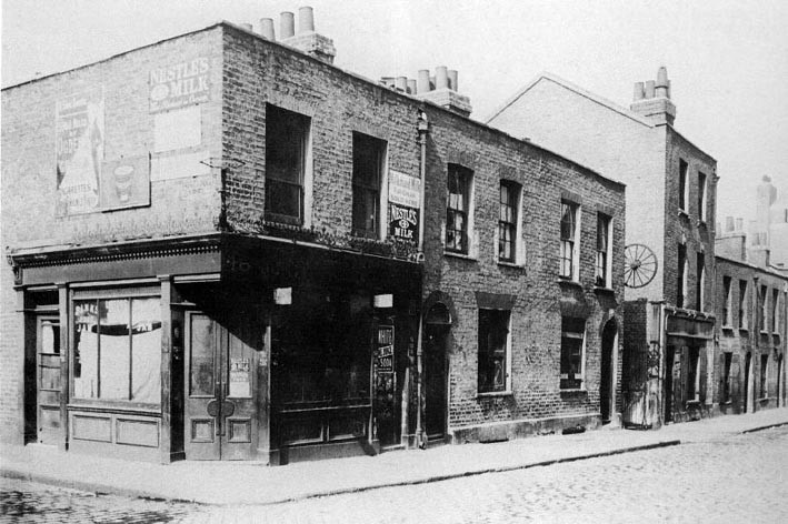
Cable Street, E1

Road in/near Stepney, existing between the 17th century and now.

 HOME  ·  ARTICLE  ·  MAPS  ·  STREETS  ·  BLOG  ·  CONTACT US 
(51.51102 -0.06643, 51.511 -0.066) 
MAP YEAR:175018001810182018301860190019502024Show map without markers
Use the control in the top right of the map above to view this area on another historic map
 
Road · * · E1 ·
November
19
2021
Cable Street started as a straight path along which hemp ropes were twisted into ships’ cables.

Cable Street originally ran straight for the length of an average ship’s cable, allowing people to lay out the ropes as they made them. However the Cable Street name has absorbed many other streets so it is now much longer. The name first appears on the 1750s Rocque maps but dates from well before this.

Cable Street starts near the edge of the City of London financial district and continues on through to Shadwell and thence to Stepney, finally to the junction between Cable Street and Butcher Row in Limehouse.

It was known by many names in its past - the Cable Street was the westernmost of the streets and existed since the beginning. The next section east was Knock Fergus, followed by New Road, Back Lane, Bluegate Field, Sun Tavern Fields and Brook Street.

The street runs parallel to (and south of) the Docklands Light Railway and Commercial Road, and is parallel but north of The Highway.

From Victorian times until the 1950s, Cable Street had a reputation for cheap lodgings, brothels, drinking inns and opium dens.

A notable piece of London trivia involves Cable Street marking the final occasion when a stake was hammered into a sinner’s heart at an official burial. This took place at the junction of Cable Street and Cannon Street Road.

John Williams had been found hanged in his cell, after being arrested as a suspect in the Ratcliff Highway murders. Local people claimed that he had committed suicide, from guilt. In 1812, suicide was considered to be sinful, and justified his burial upside down with a stake through his heart. John Williams's skull was found when new gas mains were being laid in August 1886, and was on display for many years in The Crown and Dolphin pub, opposite.

On 4 October 1936 a violent confrontation between the police and local communities on the street was later named the ’Battle of Cable Street’.

Neighbouring streets


West of Cable Street


Royal Mint Street - formerly Rosemary Lane (name changed in 1830)

North of Cable Street starting from the west


Leman Street - formerly White Lion Street, leading to Leman Street, (name changed in 1830)
Mill Yard
Back Church Lane
Pinchin Street - formerly Thomas Street (name changed in 1862). Historically noteworthy for its curve and arches, showing where the branch of the railway used to run, towards the goods yard to the north west.
Stute Street
Christian Street - the barricade created during the Battle of Cable Street was near this street’s junction with Cable Street
Golding Street - formerly Low Grove Street (name changed in 1862)
Cannon Street Road
Watney Market - formerly Watney Street (name changed in 1862)
Watney Street - formerly Charles Street (name changed in 1862)
Cornwall Street - formerly Upper Cornwall Street (name changed in 1862)
Shadwell Gardens
Shadwell Place - formerly Lower Cornwall Street and Sun Court (name changed in 1862)
Sutton Street - formerly Church Road (name changed in 1862)
Martineau Street
Johnson Street
Poonah Street
Hardinge Street
Hardinge Lane
Devonport Street
Barnardo Street - formerly James Place (name changed in 1862)
Stepney Causeway
Pitsea Street - formerly Dorset Street (name changed in 1862)
Caroline Street
Ratcliffe Cross Street - formerly Ratcliffe Square and Periwinkle Street (name changed in 1862)
Boulcott Street - formerly George Street (name changed in 1862)
Commercial Road - major radial route into Aldgate - runs parallel to Cable Street

East of Cable Street


Butcher Row - formerly Butcher Row and White Horse Street (name changed in 1862)
Narrow Street

South of Cable Street, starting from the west


Dock Street - already existed as Dock Street in 1830
Ensign Street - formerly Well Street (name changed in 1862)
Graces Alley - between Ensign Street and Wellclose Square - home to Wilton’s Music Hall
Fletcher Street - formerly Shorter Street (name changed in 1830 and 1862)
Wellclose Square - already existed as Wellclose Square in 1830 and 1862
Hindmarsh Close
Swedenbourg Gardens
Betts Street - formerly connected Cable Street to The Highway (name changed in 1862)
Crowder Street - formerly Denmark Street (name changed in 1862)
Cannon Street Road
Hawksmoor Mews
Bluegate Mews - formerly St George’s Place (name changed in 1830)
Library Place - formerly Prospect Place (name changed in 1862)
Angel Court - in 1862, Angel Gardens was where Bewley Street is now.
Dellow Street
Bewley Street - formerly Albert Street (name changed in 1862)
Sage Street
Lowood Street
Solander Gardens
Twine Court
King David Lane
Juniper Street - formerly Juniper Row (name changed in 1862)
Tarbert Walk
Glamis Road
Redcastle Close - formerly Carriage Way (name changed in 1862)
Glamis Place
Brodlove Lane - formerly Love Lane (name changed in 1862)
Elf Row - formerly Elm Row (name changed in 1862)
Glasshouse Fields - formerly Glasshouse Street (name changed in 1862)
Schoolhouse Lane
Heckford Street - formerly Burlington Place (name changed in 1862); no longer connected to Cable Street
Cranford Street - formerly Harris Court (name changed in 1862)
Bere Street - formerly connected through to Butcher Row (name changed in 1862)
Ratcliffe Orchard - formerly The Orchard (name changed in 1862)
The Highway - formerly Ratcliff Highway.
Then St George’s Street, High Street (Shadwell), Cock Hill and Broad Street (name changed in 1862)


Main source: East End Street Names | London History
Further citations and sources


Click here to explore another London street
We now have 666 completed street histories and 46834 partial histories
Find streets or residential blocks within the M25 by clicking STREETS


CONTRIBUTIONS TO THE LOCALITY

Comment
Gillian   
Added: 17 Feb 2024 00:08 GMT   

No 36 Upper East Smithfield
My great great grandfather was born at No 36 Upper East Smithfield and spent his early years staring out at a "dead wall" of St Katharine’s Docks. His father was an outfitter and sold clothing for sailors. He describes the place as being backed by tenements in terrible condition and most of the people living there were Irish.

Reply

LATEST LONDON-WIDE CONTRIBUTIONS TO THE PROJECT

Comment
Tony Whipple   
Added: 16 Apr 2024 21:35 GMT   

Frank Whipple Place, E14
Frank was my great-uncle, I’d often be ’babysat’ by Peggy while Nan and Dad went to the pub. Peggy was a marvel, so full of life. My Dad and Frank didn’t agree on most politics but everyone in the family is proud of him. A genuinely nice, knowledgable bloke. One of a kind.

Reply
Comment
Theresa Penney   
Added: 16 Apr 2024 18:08 GMT   

1 Whites Row
My 2 x great grandparents and his family lived here according to the 1841 census. They were Dutch Ashkenazi Jews born in Amsterdam at the beginning of the 19th century but all their children were born in Spitalfields.

Reply
Comment
Wendy    
Added: 22 Mar 2024 15:33 GMT   

Polygon Buildings
Following the demolition of the Polygon, and prior to the construction of Oakshott Court in 1974, 4 tenement type blocks of flats were built on the site at Clarendon Sq/Phoenix Rd called Polygon Buildings. These were primarily for people working for the Midland Railway and subsequently British Rail. My family lived for 5 years in Block C in the 1950s. It seems that very few photos exist of these buildings.

Reply

Steve   
Added: 19 Mar 2024 08:42 GMT   

Road construction and houses completed
New Charleville Circus road layout shown on Stanford’s Library Map Of London And Its Suburbs 1879 with access via West Hill only.

Plans showing street numbering were recorded in 1888 so we can concluded the houses in Charleville Circus were built by this date.

Source: Charleville Circus, Sydenham, London

Reply
Comment
Steve   
Added: 19 Mar 2024 08:04 GMT   

Charleville Circus, Sydenham: One Place Study (OPS)
One Place Study’s (OPS) are a recent innovation to research and record historical facts/events/people focused on a single place �’ building, street, town etc.

I have created an open access OPS of Charleville Circus on WikiTree that has over a million members across the globe working on a single family tree for everyone to enjoy, for free, forever.

Source: Charleville Circus, Sydenham, London

Reply
Comment
Charles   
Added: 8 Mar 2024 20:45 GMT   

My House
I want to know who lived in my house in the 1860’s.

Reply

NH   
Added: 7 Mar 2024 11:41 GMT   

Telephone House
Donald Hunter House, formerly Telephone House, was the BT Offices closed in 2000

Reply
Comment
Paul Cox   
Added: 5 Mar 2024 22:18 GMT   

War damage reinstatement plans of No’s 11 & 13 Aldine Street
Whilst clearing my elderly Mothers house of general detritus, I’ve come across original plans (one on acetate) of No’s 11 & 13 Aldine Street. Might they be of interest or should I just dispose of them? There are 4 copies seemingly from the one single acetate example. Seems a shame to just junk them as the level of detail is exquisite. No worries if of no interest, but thought I’d put it out there.

Reply


LOCAL PHOTOS
Click here to see map view of nearby Creative Commons images
Click here to see Creative Commons images near to this postcode
Click here to see Creative Commons images tagged with this road (if applicable)
46 Aldgate High Street
TUM image id: 1490910153
Licence: CC BY 2.0

In the neighbourhood...

Click an image below for a better view...
The Third Goodmans Fields Theatre, Great Alie Street (1801)
Credit: W. W. Hutchings
Licence:


Vladimir Ilyich Ulyanov (Lenin) addressing a "smoking debate" at Toynbee Hall (1902)
Licence:


The Whitechapel Gallery was designed by Charles Harrison Townsend and opened in 1901. It was one of the first publicly funded galleries in London. The gallery exhibited Pablo Picasso’s Guernica in 1938 as part of a touring exhibition organised by Roland Penrose to protest against the Spanish Civil War. Initiated by members of the Independent Group, the gallery brought Pop Art to the attention of the general public as well as introducing some of the artists, concepts, designers and photographers that would define the Swinging Sixties.
Credit: LeHaye/Wiki Commons
Licence:


Battle of Cable Street mural The Battle of Cable Street took place on the corner of Cable Street and Dock Street, and other places
Credit: Wiki CommonsAlan Denney
Licence:


Middlesex Street (Petticoat Lane) on the site of Sandy’s Row (1912)
Credit: CA Mathew/Bishopsgate Institute
Licence: CC BY 2.0


St Mary’s (Whitechapel) station (1916) This existed between 1884 and 1938 between Aldgate East and Whitechapel.
Licence:


Boy digging up an asphalt pavement in the East End (1899)
Credit: H J Malby
Licence:


Cannon Street Road in the early 1940s
Licence:


Berner Street, April 1909. The cartwheel indicates the entrance to Dutfield's Yard.
Licence: CC BY 2.0


Leman Street (1930s)
Licence: CC BY 2.0


  Contact us · Copyright policy · Privacy policy