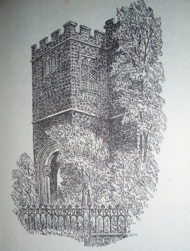
St James Duke’s Place
Church in/near City of London, existed between 1622 and 1874.
| St James Duke’s Place Church in/near City of London, existed between 1622 and 1874. |
| HOME | · | ARTICLE | · | MAPS | · | STREETS | · | BLOG | · | CONTACT US |
| MAP YEAR: | 1750 | 1800 | 1810 | 1820 | 1830 | 1860 | 1900 | 1950 | 2024 | Show map without markers |
| TIP: To create your own sharable map, right click on the map | ||||||||||
| Main source: | Wikipedia |
| Further citations and sources |
| Click here to explore another London street We now have 665 completed street histories and 46835 partial histories Find streets or residential blocks within the M25 by clicking STREETS |
| CONTRIBUTIONS TO THE LOCALITY |
  The Underground Map Added: 8 Mar 2021 15:05 GMT | A plague on all your houses Aldgate station is built directly on top of a vast plague pit, where thousands of bodies are apparently buried. No-one knows quite how many. Reply |
  Pearl Foster Added: 20 Mar 2023 12:22 GMT | Dukes Place, EC3A Until his death in 1767, Daniel Nunes de Lara worked from his home in Dukes Street as a Pastry Cook. It was not until much later the street was renamed Dukes Place. Daniel and his family attended the nearby Bevis Marks synagogue for Sephardic Jews. The Ashkenazi Great Synagogue was established in Duke Street, which meant Daniel’s business perfectly situated for his occupation as it allowed him to cater for both congregations. Reply |
| LATEST LONDON-WIDE CONTRIBUTIONS TO THE PROJECT |
 Wendy Added: 22 Mar 2024 15:33 GMT | Polygon Buildings Following the demolition of the Polygon, and prior to the construction of Oakshott Court in 1974, 4 tenement type blocks of flats were built on the site at Clarendon Sq/Phoenix Rd called Polygon Buildings. These were primarily for people working for the Midland Railway and subsequently British Rail. My family lived for 5 years in Block C in the 1950s. It seems that very few photos exist of these buildings. Reply |
  Steve Added: 19 Mar 2024 08:42 GMT | Road construction and houses completed New Charleville Circus road layout shown on Stanford’s Library Map Of London And Its Suburbs 1879 with access via West Hill only. Plans showing street numbering were recorded in 1888 so we can concluded the houses in Charleville Circus were built by this date. Source: Charleville Circus, Sydenham, London Reply |
Steve Added: 19 Mar 2024 08:04 GMT | Charleville Circus, Sydenham: One Place Study (OPS) One Place Study’s (OPS) are a recent innovation to research and record historical facts/events/people focused on a single place �’ building, street, town etc. I have created an open access OPS of Charleville Circus on WikiTree that has over a million members across the globe working on a single family tree for everyone to enjoy, for free, forever. Source: Charleville Circus, Sydenham, London Reply |
Charles Added: 8 Mar 2024 20:45 GMT | My House I want to know who lived in my house in the 1860’s. Reply |
 NH Added: 7 Mar 2024 11:41 GMT | Telephone House Donald Hunter House, formerly Telephone House, was the BT Offices closed in 2000 Reply |
Paul Cox Added: 5 Mar 2024 22:18 GMT | War damage reinstatement plans of No’s 11 & 13 Aldine Street Whilst clearing my elderly Mothers house of general detritus, I’ve come across original plans (one on acetate) of No’s 11 & 13 Aldine Street. Might they be of interest or should I just dispose of them? There are 4 copies seemingly from the one single acetate example. Seems a shame to just junk them as the level of detail is exquisite. No worries if of no interest, but thought I’d put it out there. Reply |
 Diana Added: 28 Feb 2024 13:52 GMT | New Inn Yard, E1 My great grandparents x 6 lived in New Inn Yard. On this date, their son was baptised in nearby St Leonard’s Church, Shoreditch Source: BDM London, Cripplegate and Shoreditch registers written by church clerk. Reply |
Vic Stanley Added: 24 Feb 2024 17:38 GMT | Postcose The postcode is SE15, NOT SE1 Reply |
| LOCAL PHOTOS |