Brockwell Park

Park in/near Herne Hill, existing between 1891 and now.

 HOME  ·  ARTICLE  ·  MAPS  ·  STREETS  ·  BLOG  ·  CONTACT US 
(51.45 -0.106, 51.45 -0.106) 
MAP YEAR:175018001810182018301860190019502024Show map without markers
Use the control in the top right of the map above to view this area on another historic map
 
Park · * · SE24 ·
October
2
2020
Brockwell Park is a 50 hectare park located between Brixton, Herne Hill and Tulse Hill.

The Grade II listed Brockwell Hall was originally built between 1811-1813 when the area was part of Surrey and was the country seat of glass merchant John Blades as the centrepiece of his Park Estate. The perimeter of today’s park reflects the boundary of the original estate.

The land and house were acquired by the London County Council (LCC) in March 1891 and opened to the public on 2 June in the following summer, led by the local MP Thomas Lynn Bristowe. At the unveiling, he died of a heart attack on the steps of Brockwell Hall.

In 1901 the LCC acquired a further 43 acres of land north of the original park.

J.J. Sexby, the Chief Officer of Parks of the LCC designed the conversion of the estate into a public park. When he came to the estate he described it as displaying "a wildness ... the beauties of Nature unadorned... long stretches of undulating grassland dotted here and there with fine specimen trees ... When it was bought for the people of London, it was already a park - not a park site."

Sexby introduced recreational activities, a swimming pond, lakes and cascades, a rustic bandstand and floral carpet bedding near the Hall. Tea Rooms operated in the Hall from the beginning and a children’s gymnasium was installed in the stable yard between the Hall and the stable block.

In the 1920s, there were 13 cricket pitches in the park, which attracted crowds of up to 1500. Brockwell Park was home to the Galton Institute.

The Lido open air swimming pool opened in 1937, leaving the old pond to model boats and later geese. A children’s playground, all-weather football pitches and tennis courts were also added. While building the first phase of the Tulse Hill Estate in 1939, the LCC added an access onto Tulse Hill itself, with a way through the new estate to the Brixton Hill area beyond.

Since 1892, Brockwell Hall has hosted a café on the ground floor. Brockwell Hall was restored after extensive fire damage to the main block in February 1990, and presents a view that is very close to the original Georgian concept of a country house set in a park estate.


Main source: Wikipedia
Further citations and sources


Click here to explore another London street
We now have 666 completed street histories and 46834 partial histories
Find streets or residential blocks within the M25 by clicking STREETS


CONTRIBUTIONS TO THE LOCALITY

None so far :(
LATEST LONDON-WIDE CONTRIBUTIONS TO THE PROJECT

Comment
Tony Whipple   
Added: 16 Apr 2024 21:35 GMT   

Frank Whipple Place, E14
Frank was my great-uncle, I’d often be ’babysat’ by Peggy while Nan and Dad went to the pub. Peggy was a marvel, so full of life. My Dad and Frank didn’t agree on most politics but everyone in the family is proud of him. A genuinely nice, knowledgable bloke. One of a kind.

Reply
Comment
Theresa Penney   
Added: 16 Apr 2024 18:08 GMT   

1 Whites Row
My 2 x great grandparents and his family lived here according to the 1841 census. They were Dutch Ashkenazi Jews born in Amsterdam at the beginning of the 19th century but all their children were born in Spitalfields.

Reply
Comment
Wendy    
Added: 22 Mar 2024 15:33 GMT   

Polygon Buildings
Following the demolition of the Polygon, and prior to the construction of Oakshott Court in 1974, 4 tenement type blocks of flats were built on the site at Clarendon Sq/Phoenix Rd called Polygon Buildings. These were primarily for people working for the Midland Railway and subsequently British Rail. My family lived for 5 years in Block C in the 1950s. It seems that very few photos exist of these buildings.

Reply

Steve   
Added: 19 Mar 2024 08:42 GMT   

Road construction and houses completed
New Charleville Circus road layout shown on Stanford’s Library Map Of London And Its Suburbs 1879 with access via West Hill only.

Plans showing street numbering were recorded in 1888 so we can concluded the houses in Charleville Circus were built by this date.

Source: Charleville Circus, Sydenham, London

Reply
Comment
Steve   
Added: 19 Mar 2024 08:04 GMT   

Charleville Circus, Sydenham: One Place Study (OPS)
One Place Study’s (OPS) are a recent innovation to research and record historical facts/events/people focused on a single place �’ building, street, town etc.

I have created an open access OPS of Charleville Circus on WikiTree that has over a million members across the globe working on a single family tree for everyone to enjoy, for free, forever.

Source: Charleville Circus, Sydenham, London

Reply
Comment
Charles   
Added: 8 Mar 2024 20:45 GMT   

My House
I want to know who lived in my house in the 1860’s.

Reply

NH   
Added: 7 Mar 2024 11:41 GMT   

Telephone House
Donald Hunter House, formerly Telephone House, was the BT Offices closed in 2000

Reply
Comment
Paul Cox   
Added: 5 Mar 2024 22:18 GMT   

War damage reinstatement plans of No’s 11 & 13 Aldine Street
Whilst clearing my elderly Mothers house of general detritus, I’ve come across original plans (one on acetate) of No’s 11 & 13 Aldine Street. Might they be of interest or should I just dispose of them? There are 4 copies seemingly from the one single acetate example. Seems a shame to just junk them as the level of detail is exquisite. No worries if of no interest, but thought I’d put it out there.

Reply


LOCAL PHOTOS
Click here to see map view of nearby Creative Commons images
Click here to see Creative Commons images near to this postcode
Zebra taxi
TUM image id: 1557317410
Licence: CC BY 2.0
Due to the steepness of Brixton Hill, it was difficult for two horses to pull a tram full of passengers. As a result, an Act of Parliament was obtained in 1890 to allow the London Tramways Company (formerly known as the Metropolitan Street Tramways Company) to build a cable line. This cable line would replace the existing horse tram service from Kennington to Brixton Water Lane and continue all the way up to Telford Avenue at the top of Brixton Hill. The concept of cable traction was already in use in San Francisco, and it was first implemented in the UK on Highgate Hill in North London in 1884. The cable was composed of steel wire strands wrapped around a one-inch diameter rope, which extended almost six miles in length. This was twice the length of the actual route. The cable ran underground between the tram lines within a concrete conduit that had a small open slot along the rope. The small human-operated tractor or "gripper" car utilised this slot to grip onto the cable and pull the passenger tramcar. If a tramcar was traveling from Brixton Hill to Westminster Bridge, the gripper car would be detached at Kennington and replaced by a pair of horses. Passengers remained in their seats during this transition. The cable moved continuously at a maximum speed of 8 miles per hour. A special depot was constructed on Streatham Hill, opposite Telford Avenue, to house the cars, horses, and steam-powered winding gear for the cable. The cable service began operating in December 1892. In 1894, another Act was obtained to extend the cable line southwards to the Tate Library on Streatham High Road, and this section was operational by the end of 1895. The cable cars ran until 1904.
Old London postcard
TUM image id: 1682856950
Licence:
Electric Avenue, Brixton, c.1900
TUM image id: 1510061901
Licence: CC BY 2.0

In the neighbourhood...

Click an image below for a better view...
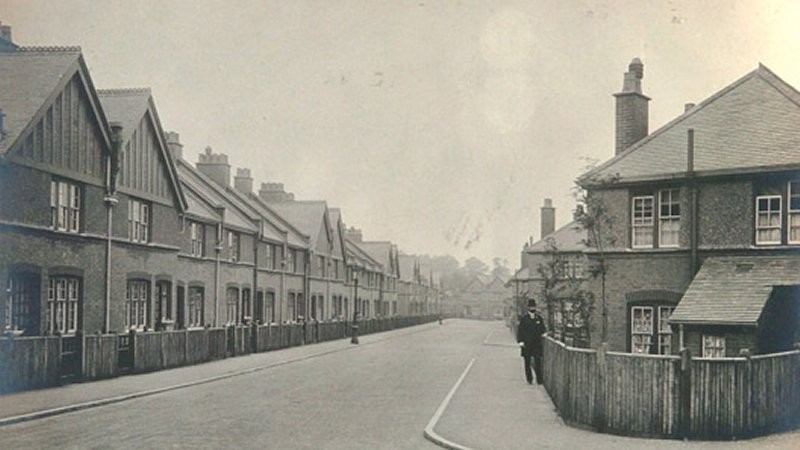
Rosendale Road, SE24 consists of a mixture of flats and cottages, built between 1902 and 1908. A community hall was added in 1913. A “Jubilee concert” took place there in March 1914 to mark the 50th anniversary of the opening of the first Peabody estate in Spitalfields. The blocks of flats resemble earlier Peabody estates, except that red brick was used instead of yellow. Block F included a communal bathhouse. For the final phase of building a new architect was selected to design 64 of the cottages. He was Victor Wilkins, who remained as Peabody’s architect until his retirement in 1948.
Credit: Peabody Trust
Licence:


Mumford Road, SE24 Despite this being the tiniest of cul-de-sacs, Mumford Road once had a different name. A householder needed an outflow pipe to be installed causing the Mumford Road sign to be moved down and revealing a sign with the older name.
Licence:


  Contact us · Copyright policy · Privacy policy