Heath House

Large house in/near Hampstead, existing between the 1790s and now.

 HOME  ·  ARTICLE  ·  MAPS  ·  STREETS  ·  BLOG  ·  CONTACT US 
(51.5631 -0.1796, 51.563 -0.179) 
MAP YEAR:175018001810182018301860190019502024Show map without markers
TIP: To create your own sharable map, right click on the map
 
Large house · * · NW3 ·
November
20
2020
Heath House is a Grade II* listed historic mansion on Hampstead Heath.

From 1790 Heath House was the London seat of banker and philanthropist Sir Samuel Hoare. It remained in his family until the house was badly damaged in the Second World War and was sold. The branch of the Hoare family at the house were Quakers and played a significant part in philanthropy and public life. Several members of the family were also members of Parliament, including Sir Samuel Hoare, 1st Baronet who held the Norwich seat, his son Sir Samuel Hoare (Viscount Templewood) who was Foreign Secretary and Home Secretary. Edward Brodie Hoare was MP for Hampstead.

The house has been associated with Elizabeth Fry (who married into the family) and William Wilberforce with whom the Hoare family fought for abolition of slavery.

After the Second World War, after a number of years of dereliction, Heath House was bought by Donald Forrester who undertook a major renovation on the building and the grounds. It then became a Forrester family home for several years.

From 1969 to 1975, Heath House was the home of the Central Tutorial School for Young Musicians (renamed 'The Purcell School').

The Hampstead War Memorial stands in front of the house.


Main source: Wikipedia
Further citations and sources


Click here to explore another London street
We now have 666 completed street histories and 46834 partial histories
Find streets or residential blocks within the M25 by clicking STREETS


CONTRIBUTIONS TO THE LOCALITY

None so far :(
LATEST LONDON-WIDE CONTRIBUTIONS TO THE PROJECT

Comment
Theresa Penney   
Added: 16 Apr 2024 18:08 GMT   

1 Whites Row
My 2 x great grandparents and his family lived here according to the 1841 census. They were Dutch Ashkenazi Jews born in Amsterdam at the beginning of the 19th century but all their children were born in Spitalfields.

Reply
Comment
Wendy    
Added: 22 Mar 2024 15:33 GMT   

Polygon Buildings
Following the demolition of the Polygon, and prior to the construction of Oakshott Court in 1974, 4 tenement type blocks of flats were built on the site at Clarendon Sq/Phoenix Rd called Polygon Buildings. These were primarily for people working for the Midland Railway and subsequently British Rail. My family lived for 5 years in Block C in the 1950s. It seems that very few photos exist of these buildings.

Reply

Steve   
Added: 19 Mar 2024 08:42 GMT   

Road construction and houses completed
New Charleville Circus road layout shown on Stanford’s Library Map Of London And Its Suburbs 1879 with access via West Hill only.

Plans showing street numbering were recorded in 1888 so we can concluded the houses in Charleville Circus were built by this date.

Source: Charleville Circus, Sydenham, London

Reply
Comment
Steve   
Added: 19 Mar 2024 08:04 GMT   

Charleville Circus, Sydenham: One Place Study (OPS)
One Place Study’s (OPS) are a recent innovation to research and record historical facts/events/people focused on a single place �’ building, street, town etc.

I have created an open access OPS of Charleville Circus on WikiTree that has over a million members across the globe working on a single family tree for everyone to enjoy, for free, forever.

Source: Charleville Circus, Sydenham, London

Reply
Comment
Charles   
Added: 8 Mar 2024 20:45 GMT   

My House
I want to know who lived in my house in the 1860’s.

Reply

NH   
Added: 7 Mar 2024 11:41 GMT   

Telephone House
Donald Hunter House, formerly Telephone House, was the BT Offices closed in 2000

Reply
Comment
Paul Cox   
Added: 5 Mar 2024 22:18 GMT   

War damage reinstatement plans of No’s 11 & 13 Aldine Street
Whilst clearing my elderly Mothers house of general detritus, I’ve come across original plans (one on acetate) of No’s 11 & 13 Aldine Street. Might they be of interest or should I just dispose of them? There are 4 copies seemingly from the one single acetate example. Seems a shame to just junk them as the level of detail is exquisite. No worries if of no interest, but thought I’d put it out there.

Reply
Comment
Diana   
Added: 28 Feb 2024 13:52 GMT   

New Inn Yard, E1
My great grandparents x 6 lived in New Inn Yard. On this date, their son was baptised in nearby St Leonard’s Church, Shoreditch

Source: BDM London, Cripplegate and Shoreditch registers written by church clerk.

Reply


LOCAL PHOTOS
Click here to see map view of nearby Creative Commons images
Click here to see Creative Commons images near to this postcode
Soldier’s Daughters Home from the "Illustrated London News", June 19, 1858 The Royal School, Hampstead was founded in 1855 as the Soldiers’ Infant Home before becoming the Royal Soldiers’ Daughters’ School on this site in 1867. It was established "to nurse, board, clothe and educate the female children, orphans or not, of soldiers in Her Majesty’s Army killed in the Crimean War". The Daughter’s School, as described in 1902: "At the back a large extent of grass playground stretched out westward, and at the end of this there was a grove of trees. On one side of the grass is a large playroom built in 1880 by means of an opportune legacy, and on the other a covered cloister which led to the school, standing detached from the house at the other end of the playground. An old pier burdened with a mass of ivy stood up in the centre, the only remnant of this part of old Vane House. A portion of the ground was profitably sold for the frontage to Fitz John’s Avenue." The school site is now used as a senior campus of North Bridge House School.
Credit: The Illustrated London News
TUM image id: 1458756121
Licence:
Holly Walk, NW3
TUM image id: 1455451397
Licence: CC BY 2.0
Yorkshire Grey Place, NW3
TUM image id: 1456946471
Licence: CC BY 2.0
Whitestone Pond (1900s)
TUM image id: 1484920765
Licence: CC BY 2.0

In the neighbourhood...

Click an image below for a better view...
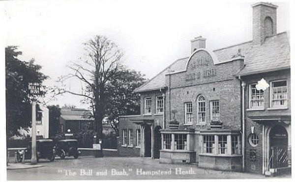
The Old Bull and Bush The Old Bull and Bush, near Hampstead Heath, gave its name to the music hall song "Down at the old Bull and Bush" sung by Florrie Forde. The interior was renovated to a modern, gastropub style in 2006. Until the introduction of the smoking ban in England in 2007, The Bull and Bush was one of the few completely smoke-free pubs in London. The earliest record of a building on the site is of a farmhouse in 1645. The farmhouse gained a licence to sell ale in 1721. William Hogarth drank here, and is believed to have been involved in planting out the pub garden.
Old London postcard
Licence:


Flask Walk, Hampstead (1922)
Credit: Charles Ginner (1878-1952)
Licence:


Holly Walk, NW3
Licence: CC BY 2.0


Removing the ’Dick Turpin House and Stables’ which once stood close to the Spaniards Inn, Hampstead, January 1934. The building caused an even narrower traffic obstruction than the pub still does today
Licence:


Spedan Close
Credit: municipaldreams.wordpress.com
Licence: CC BY 2.0


Church Row, Hampstead. This etching appears as the frontispiece of 'An introduction to Hampstead' by G.E. Mitton, published in 1902.
Licence: CC BY 2.0


Branch Hill Pond
Credit: John Constable (1776-1837)
Licence:


Whitestone Pond (1900s)
Licence: CC BY 2.0


Donkey ride, Hampstead Heath (early 1960s) Two small boys riding donkeys being led across the road in front of Whitestone Pond. Photographed by John Gay between 1960 and 1965
Credit: John Gay/Historic England Archive
Licence:


  Contact us · Copyright policy · Privacy policy