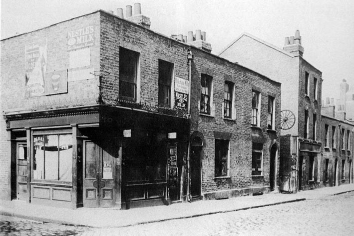
 Berner Street (now Henriques Street), April 1909. The cartwheel indicates the entrance to Dutfield's Yard.
The street first appeared on Horwood's map of 1807 when it was little more than an incomplete cul-de-sac. Possibly named after Charles Berner, a trustee of the vestry of St George-in-the-east, it had become fully developed by the 1830s.
The Berner Street/Dutfield's Yard area was demolished in 1909 to make way for a new school which is today the Harry Gosling Primary School. Attribution: User unknown/public domain
Licence: Not known


