Area photos


 HOME  ·  ARTICLE  ·  MAPS  ·  STREETS  ·  BLOG  ·  CONTACT US 
(51.50664 -0.20272, 51.506 -0.202) 


LOCAL PHOTOS
Click here to see map view of nearby Creative Commons images
Click here to see Creative Commons images near to this postcode
Click here to see Creative Commons images tagged with this road (if applicable)
Notting Hill
TUM image id: 1510169244
Licence: CC BY 2.0
Pembridge Road (1900s)
TUM image id: 1556889569
Licence: CC BY 2.0
Abingdon Arms Pub, Abingdon Road.
TUM image id: 1489943648
Licence: CC BY 2.0
Boyne Terrace Mews, W11
TUM image id: 1453967964
Licence: CC BY 2.0

In the neighbourhood...

Click an image below for a better view...
Children of Ruston Close This road was the renaming of Rillington Place. Even after renaming, this street, where notorious murders had taken place, proved too much to avoid subsequent demolition.
Licence:


Pembridge Road (1900s)
Licence: CC BY 2.0


St Peter's Notting Hill
Credit: Asteuartw
Licence: CC BY 2.0


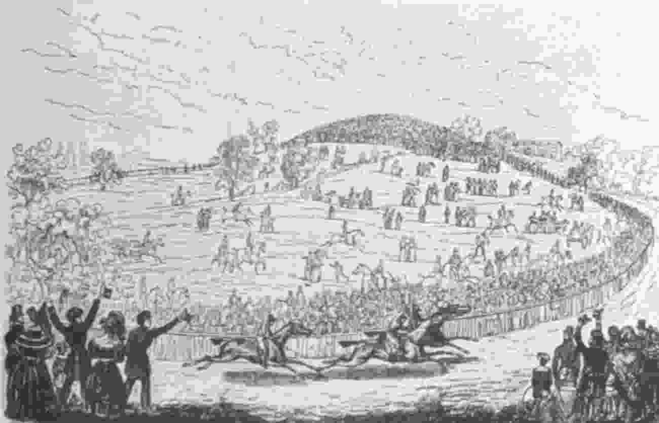
Kensington Hippodrome, about 1840, showing St John’s Hill in the background.
Licence:


Abbotsbury Road, Holland Park (2008) These houses are just beside an entrance to Holland Park. Further along the road was the Maharishi Mahesh Yogi meditation centre visited by the Beatles in 1967.
Credit: Geograph/David Hawgood
Licence:


Boyne Terrace Mews, W11
Licence: CC BY 2.0


Pump attendant at a Lex Garage in Campden Hill Road, Kensington fills up for a customer (1952) In the 1950s, petrol pumps were still largely attached to garage workshops. People didn’t yet use the term “petrol station“ but instead “garage”.
Credit: Kurt Hutton/Picture Post
Licence:


3-4 Ladbroke Terrace in 2006.
Licence: CC BY 2.0


Holland Park Avenue c.1900, looking west
Credit: Royal Borough of Kensington and Chelsea
Licence:


Ladbroke Grove, W11 (2017)
Credit: Flickr/Jorge Franganillo
Licence: